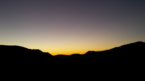
There was disappointment in the air. We all felt it. I zipped my jacket up to the top, tightened the velcro on my cuffs, and pulled my hat tight round my ears. Nestling myself perfectly between two rocks, it was the comfiest I had felt since I was curled up in my sleeping bag 7 hours earlier. As I ate my sandwiches, I tried not to look up towards Glas Bheinn Mhor but I couldn’t help myself – even though I could only see some of it, it didn’t look particularly steep and from this angle the ridge was only slightly undulating. It didn’t matter, we were leaving it for another day.
The walk had been planned since December 2014, and earlier that morning the prospect of abandoning the route after less than halfway hadn’t entered any of our minds. No way. Especially as the Mountain Weather Information Services had forecast no rain, less than 10mph winds, and 90% chance of a cloud free summit. Pfft, gid yin.
We had arrived the night before. It was Friday and the three of us had finished work early to ensure we gave ourselves enough daylight to drive up to Glen Etive and make a start on the walk. Ben Starav, Beinn nan Aighenan, Glas Bheinn Mhor, Stob Coire an Albannaich, and Meall nan Eun were the 5 munros we were planning on walking – The Ben Starav 5.
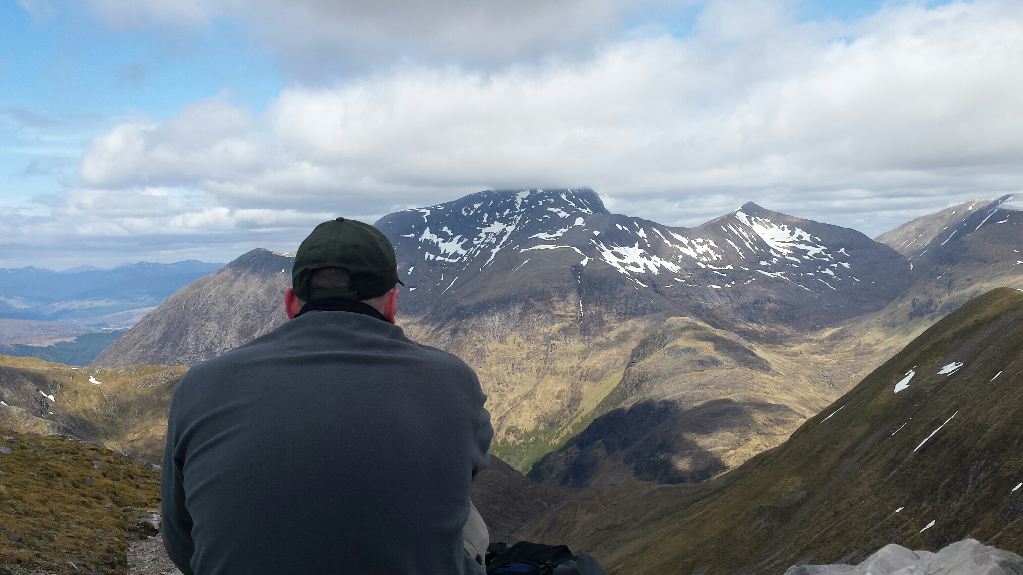
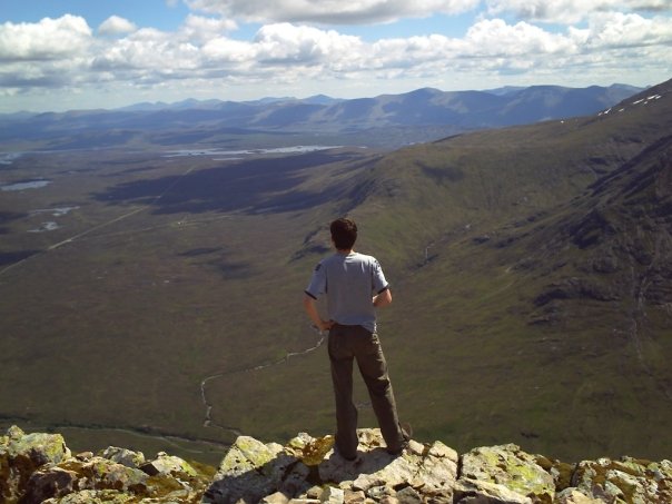
As we set off from the roadside, each of us with full packs, I noticed the very little cloud that was lingering had almost completely cleared to give us maximum daylight. This was a good sign, since we had agreed to try make it up to the summit of Ben Starav for sunset, and looking up at the mountain from almost sea level, I had already started doubting whether that would actually happen. We made our way around the old farm house that tucks itself in amongst the trees that line the River Etive, and danced over the boggy field before we got to the burn named Allt Mheuran. I had been here before on a previous non-starter of an attempt to do Ben Starav a year before so suggested we filled up on water as I knew it was the last chance we would get. This section of the burn is fast flowing even in low water levels due to the huge rocks and boulders that are strewn all over the place. They force the burn to wind its way in and about them at a fast pace causing a white water effect, smoothing any corners and polishing any flat surfaces as it goes. The three humans were aware of this but the tiny canine we had with us never got the memo and found out the hard way when he slipped and got washed away with the water. Luckily wee Franklin only ended up in a small pool a couple metres downstream so nothing serious, but I don’t think he was happy about his impromptu highland bath.
At this point, we realised we weren’t going to get to the top of Ben Starav before sunset so we decided to keep climbing the hill until we came across a flattish space to camp that still offered a view. Nearly an hour later, I came across a section of the ridge that would suit my tent, it looked over towards Beinn Trilleachan with a view down to where the River Etive ends and Loch Etive begins. Jim and Rory were less fussy about where we were camping since they were using their bivvy bags, not that I could ask their opinion anyway since they had lagged so far behind! Slackers. We got ourselves set up just in time to watch the sun paint the sky with rays of red, pink, and orange before it dipped down behind the summit of Beinn Trilleachan. Not long after, the temperature dropped and it wasn’t long after that before we were all crashing out – Jim, Franklin and Rory snuggling inside their makeshift cairn and me in my tent.
Looking back along Glen Etive from the slopes of Ben Starav.
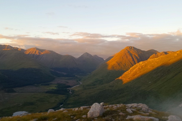
Sunset over Beinn Trilleachan.
I was the designated alarm for the morning and was aiming to get everyone up at 6am latest to set off early – of course this never happened, and it was more like 7:45 before we had packed up our stuff. The sun hadn’t quite crept all the way into the glen yet and parts of the mountainscape were still asleep in the dark, there were slithers of cloud looming around us and it looked like more were forming by the second. This was making me want to get going as the last thing I wanted to do was to eat my breakfast sitting in the wet mist. Even so, we still weren’t in any rush because, well… we never are. No matter what plans we set, timescales usually go out the window, which I suppose can be good and bad in different ways.
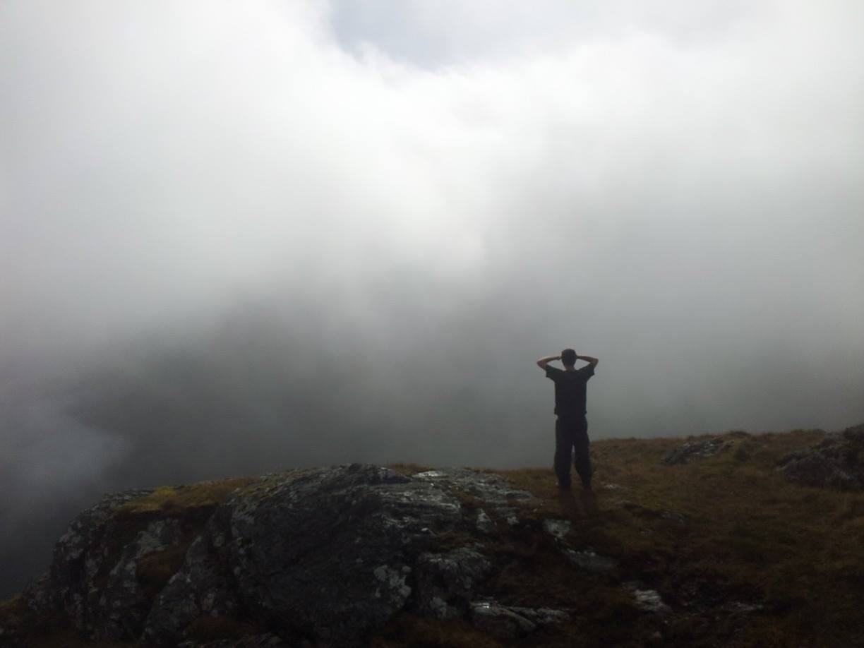
We had only been walking about fifteen minutes before the views down to the floor of the glen were swallowed up by the cloud. We couldn’t see anything below us and could only see tiny glimpses of what was above us. The sun was still poking through, giving off that awkward shine when there’s a layer of cloud infront of it that seems to magnify the brightness rather than restrict it. In short, if we looked down we seen nothing, if we looked up we seen nothing.
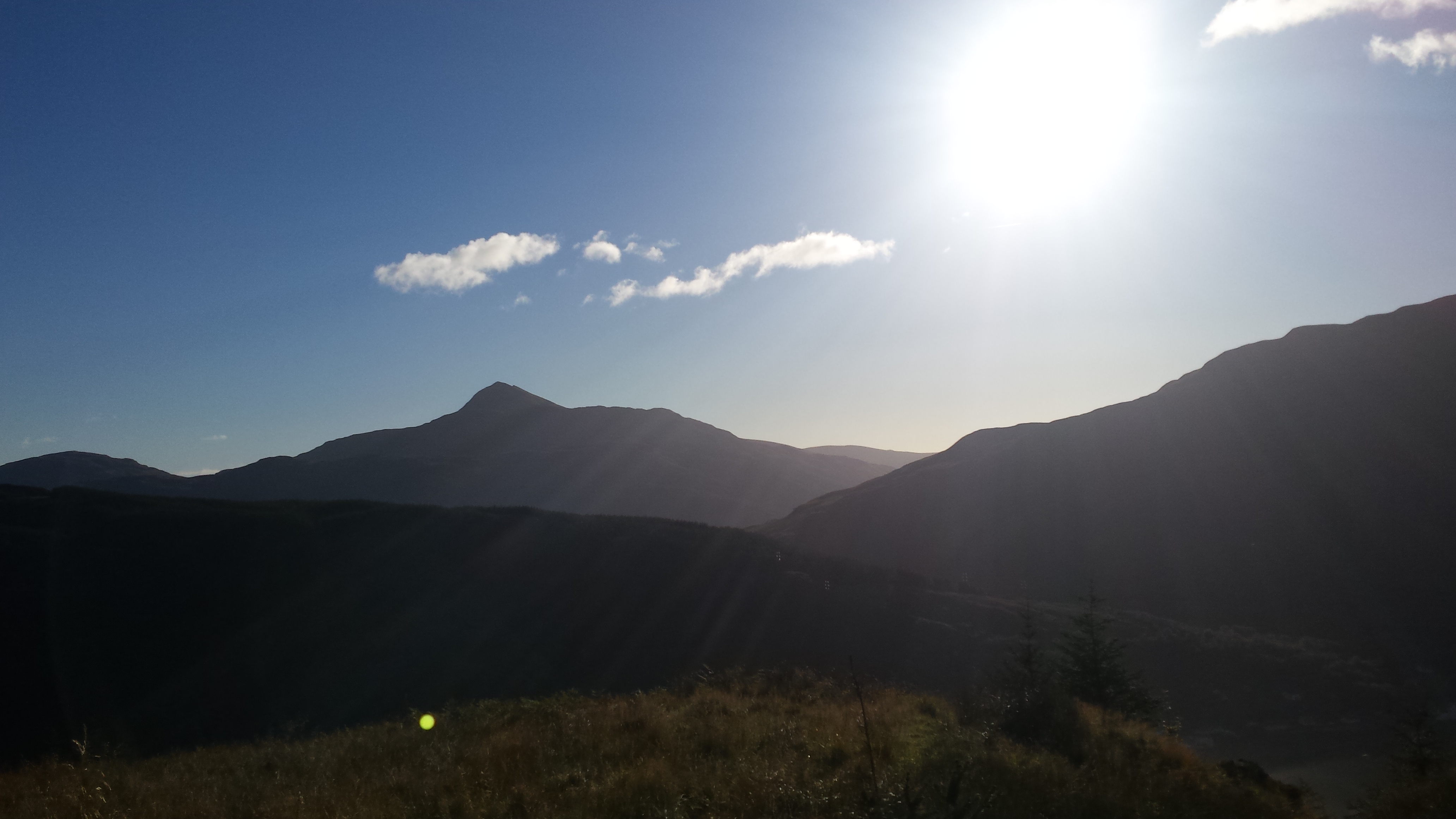
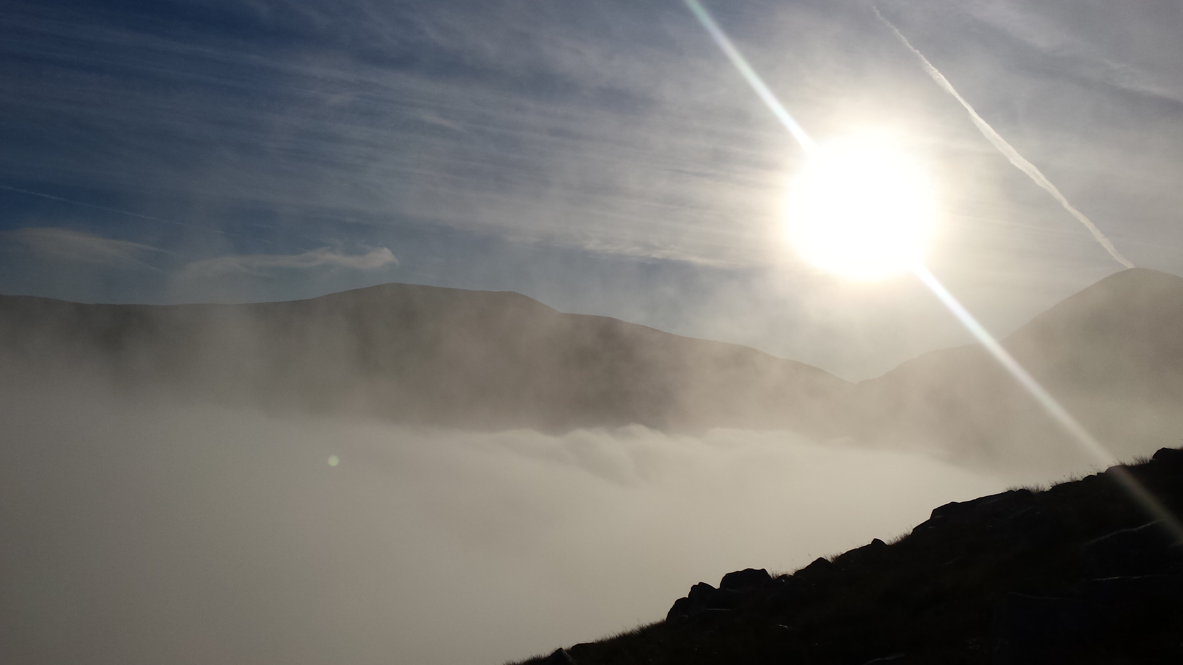
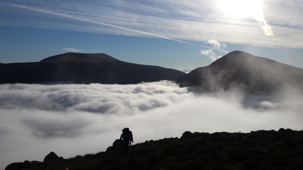
Due to the sheer and brute mass of Ben Starav, the ascent is unrelenting which means while we were walking, we were gaining height rapidly. More rapid it seemed, than the cloud could rise. Eventually we started getting clear glimpses of the surrounding mountain tops, and the bluest sky I had ever seen started showing itself. I suddenly became more awake, the sluggishness of the early morning was being left behind with every new step. Was I going to experience my first ever mist inversion?
Yes.
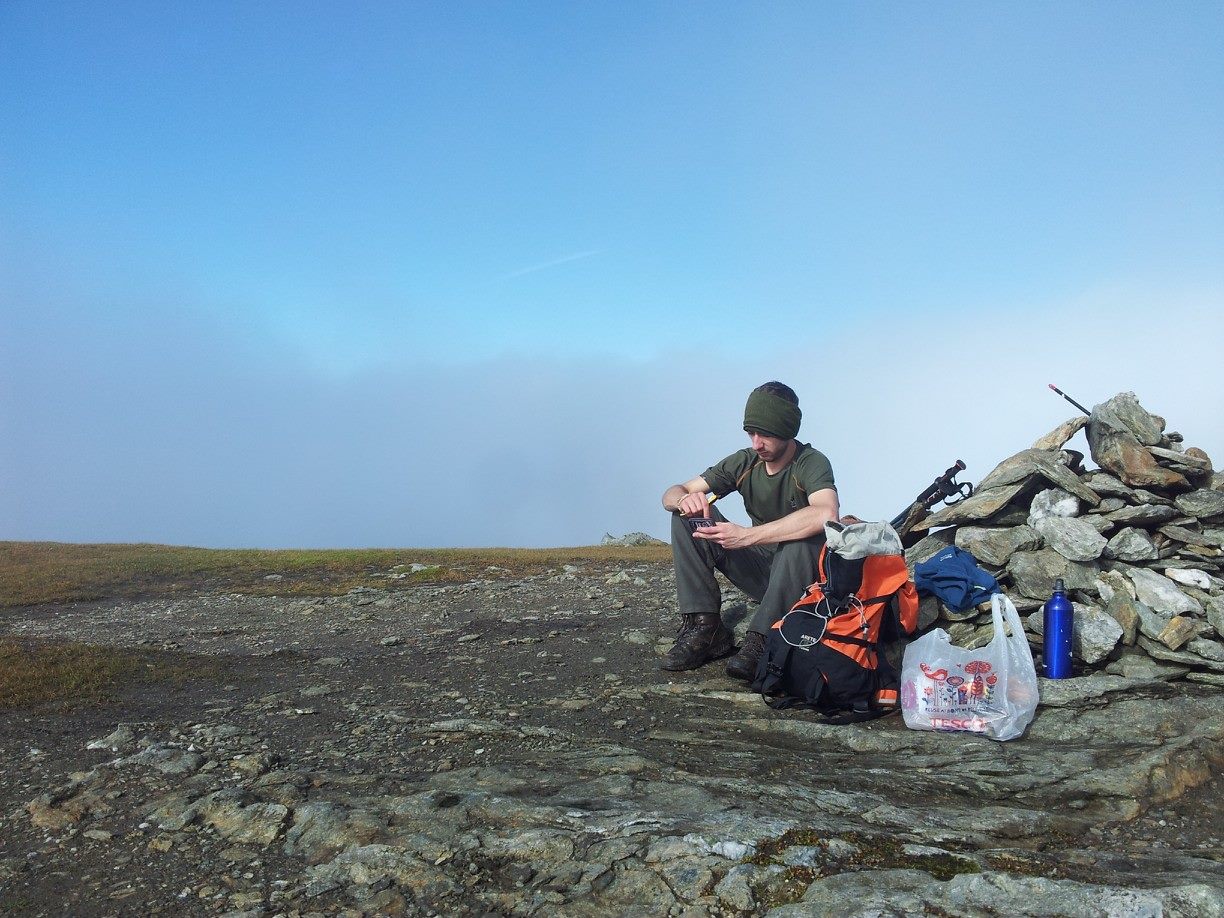
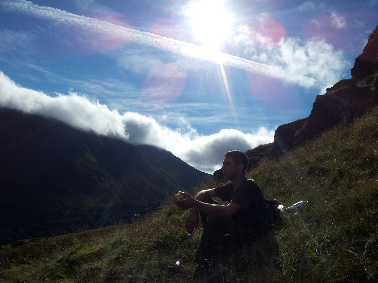
In the space of about 30 seconds the landscape changed around us. We didn’t stop walking but the smiles on our faces grew wider with every footstep. The temperature changed, the wind disappeared, and the cloud transformed from a light grey, wispy floating mass into a defeated carpet of bright white cotton wool. And we were high above it all. We carried on for about five minutes taking photos, and walking backwards up the hill so we could keep looking at the unbelievable view before we finally decided that this would be a perfect time to sit and enjoy breakfast.

The morning mist beginning to settle.
Some people I know don’t understand why I choose to trudge up and down hills. And I’ll admit that there are rare times I even question the logic myself. But it doesn’t matter what happens on the hill, who I’m with, if I’m with anyone at all, what the weather’s doing, or where I am… there’s always something that makes it worthwhile, something I remember about the trip that I talk about long after I’m back at sea level and I’ve unpacked my rucksack. This was going to be it.
Seconds after we realised a mist inversion was happening.
I had waited more than 7 years to sit above the clouds like this. I had waited more than 7 years to see the tops of the highest mountains in the area be the only part not hidden. I had waited more than 7 years to compare my real life experience to all the photos I had seen of other people sitting above the clouds, and today seemed better than them all. I had waited more than 7 years… and I forgot to get someone to take a fucking photo of me.
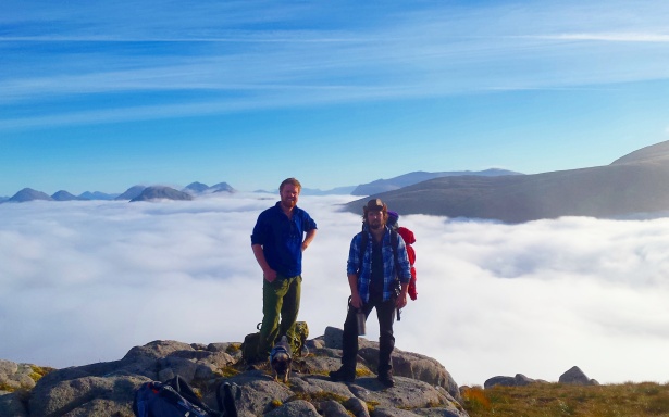
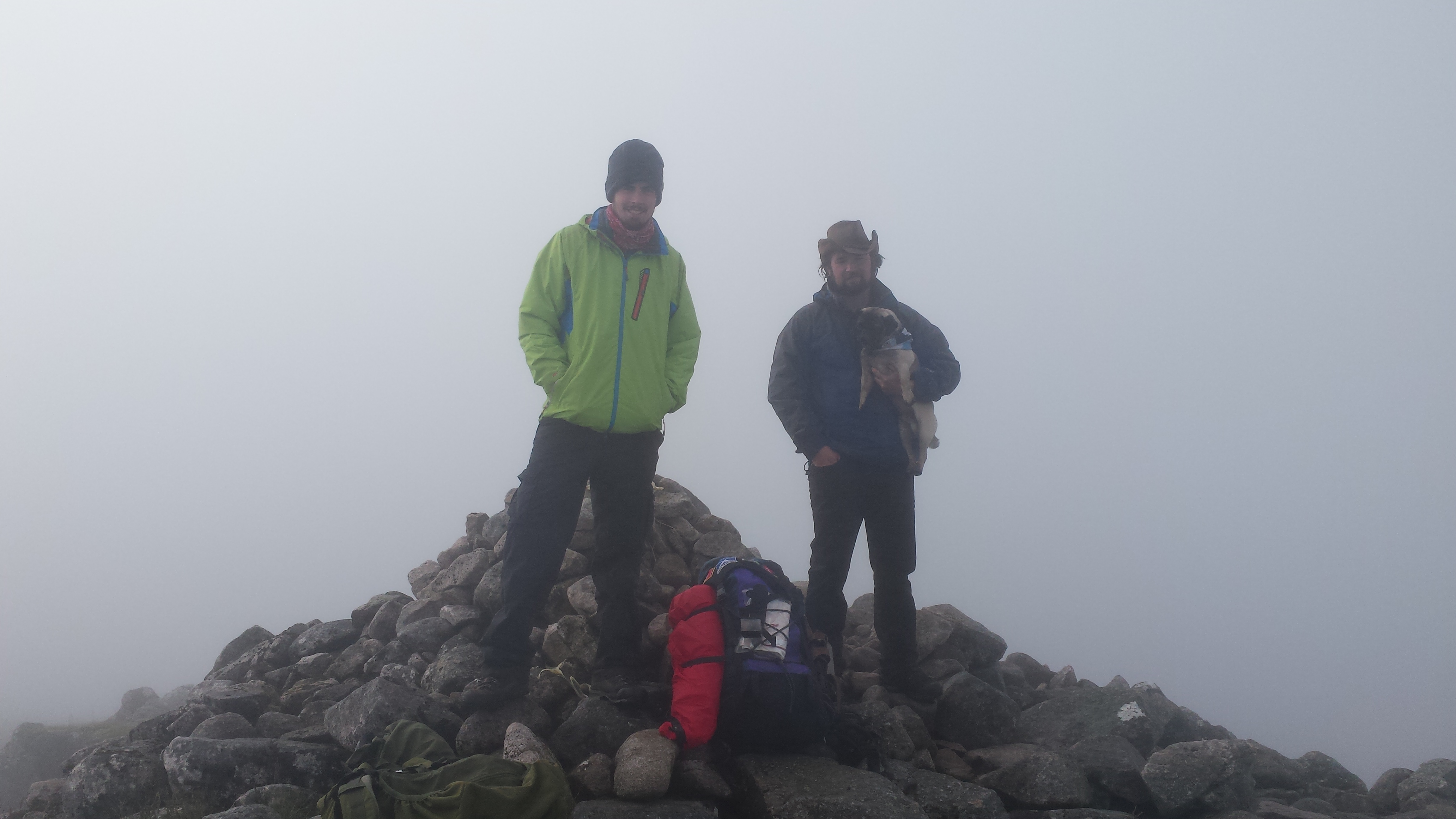
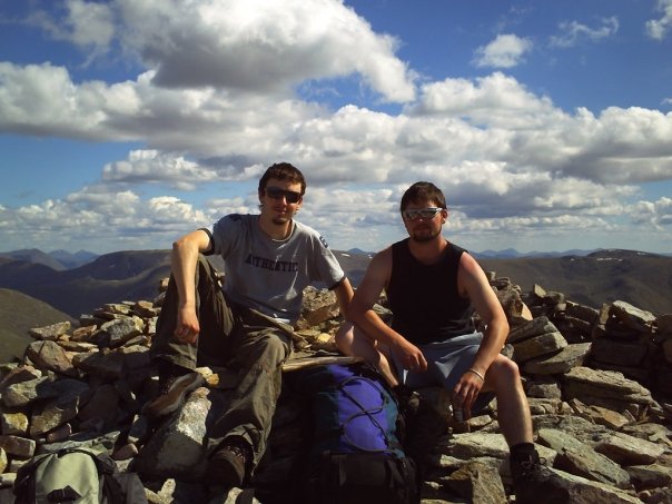
Rory, The Cairngorm Cowboy and Franklin the Pug with the carpet of cotton wool behind them.
As much as we wanted to hang about and enjoy the views, in the 45 minutes we were sat down we had finished our breakfast, finished naming all the visible mountain tops, and Franklin was getting a little restless, so we started walking again. We had five munros to get round today!
After 20 minutes of setting off again, we realised that the defeated carpet of cotton wool from earlier on was starting to rise again. So quickly actually that in the space of about five minutes, we had went from views of pristine blue sky to being enveloped in soaking wet mist. We were only about half an hour from the summit and the chance of getting a view was diminishing as fast as my smile. But we kept on and by the time we reached the summit cairn, not only were there no views, but it was bloody freezing. ‘It’s alright’, I told myself, ‘This is just the 10% in a 90% chance of a cloud free summit’. We didn’t hang about long, a couple of photos and a five minute rest from carrying the full pack and we were off again.

“90% chance of a cloud free summit.”
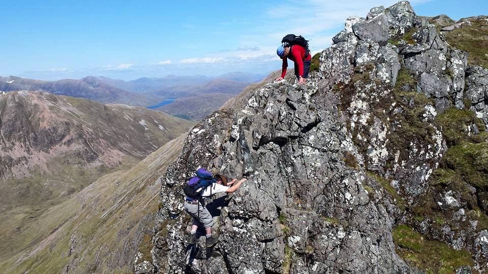
As we swung round from the summit over to the southern top a few hundred metres away, the mist showed no signs of letting up. Not that I was much fussed at this point because we were descending over a craggy part of the ridge which occupied my concentration for now with a little scrambling and pole dancing. Pole dancing is performing a mix of hopping, jumping, and tensing up whilst clutching onto my walking pole as I try not to buckle my knees in pain. Obviously. I’ve noticed in the last year that my knees have been far less tolerant than they used to be. They seem to shout and scream at me during a walk now, rather than waiting until the day after.
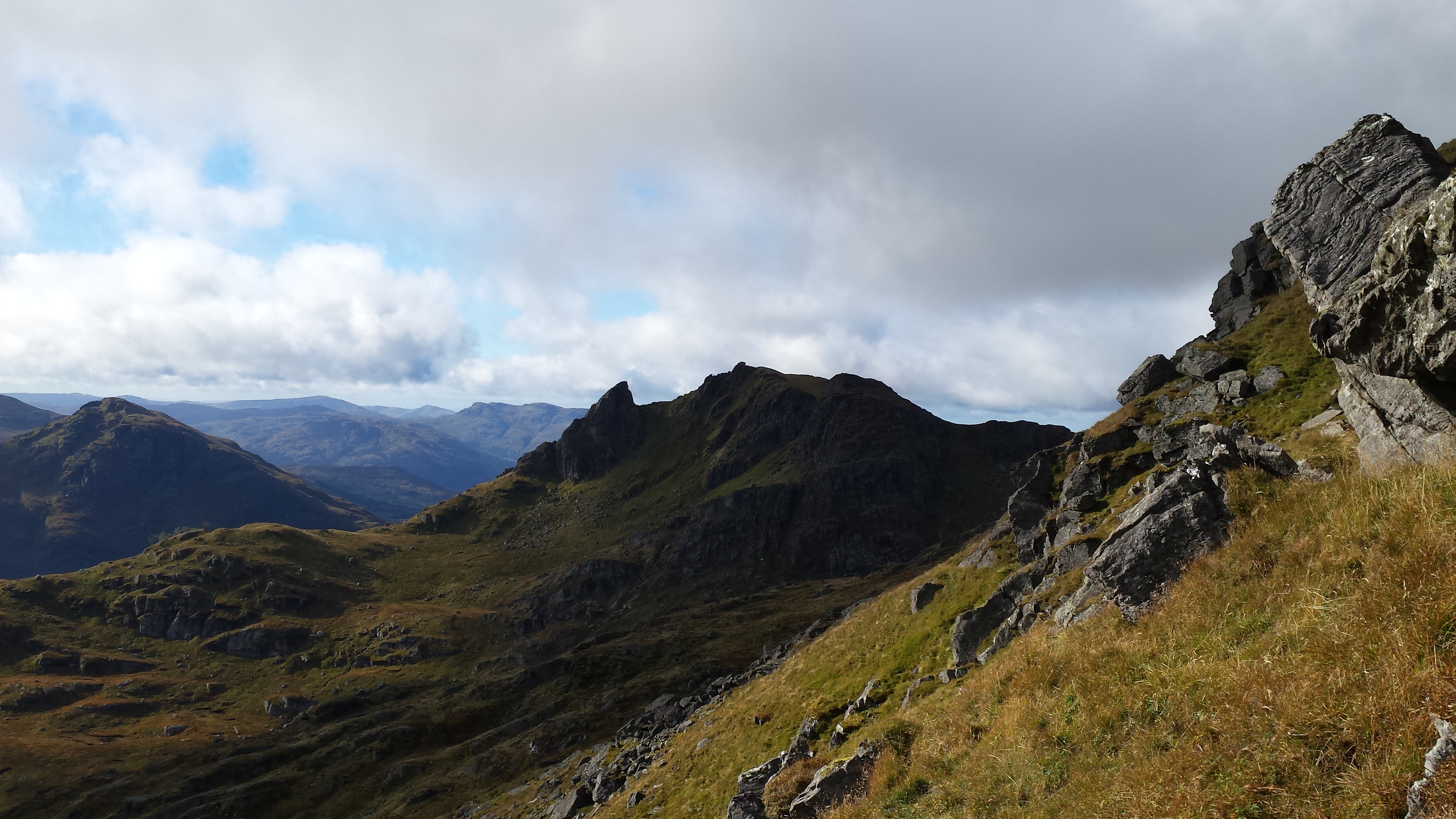
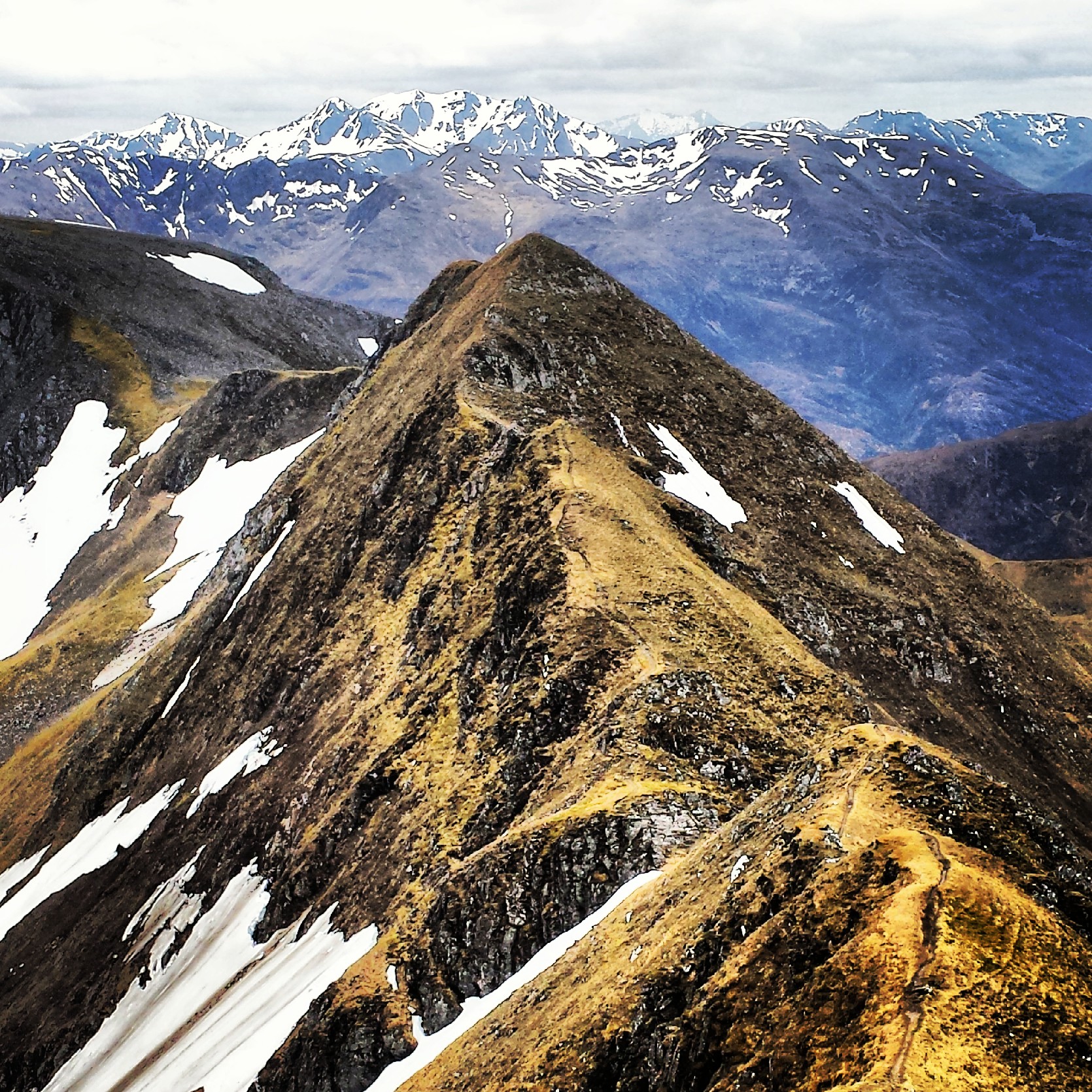
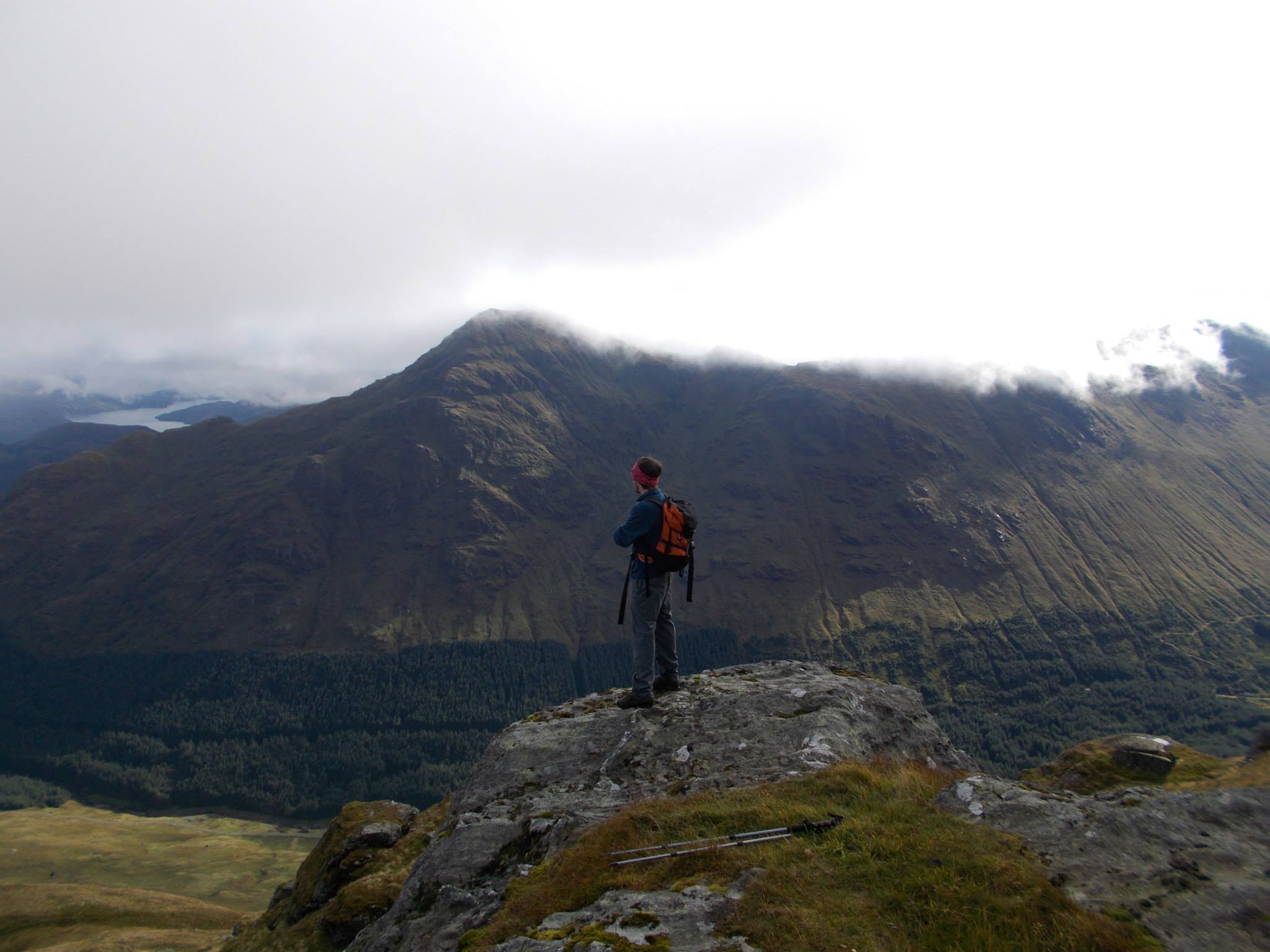
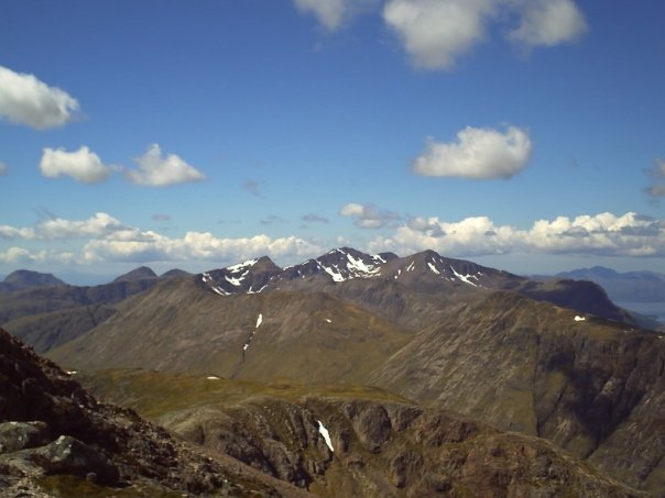
Eventually the terrain started leveling out and I managed to stop pole dancing for a while, but as we approached the bealach between the three munros of Ben Starav, Beinn nan Aighenan and Glas Bheinn Mhor, I couldn’t help but notice the euphoric feeling of earlier on was all but gone. The cloud had dispersed a wee bit, but we still couldn’t see any tops from where we were. Not only that but we were already way behind schedule due to carrying full packs, I was beginning to doubt whether we would make it round the full route by the time darkness arrived. I didn’t say anything at the time though, nobody did. We were mostly talking about how pish poor the weather forecast had been! Which it had.
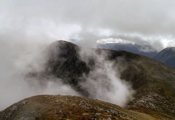
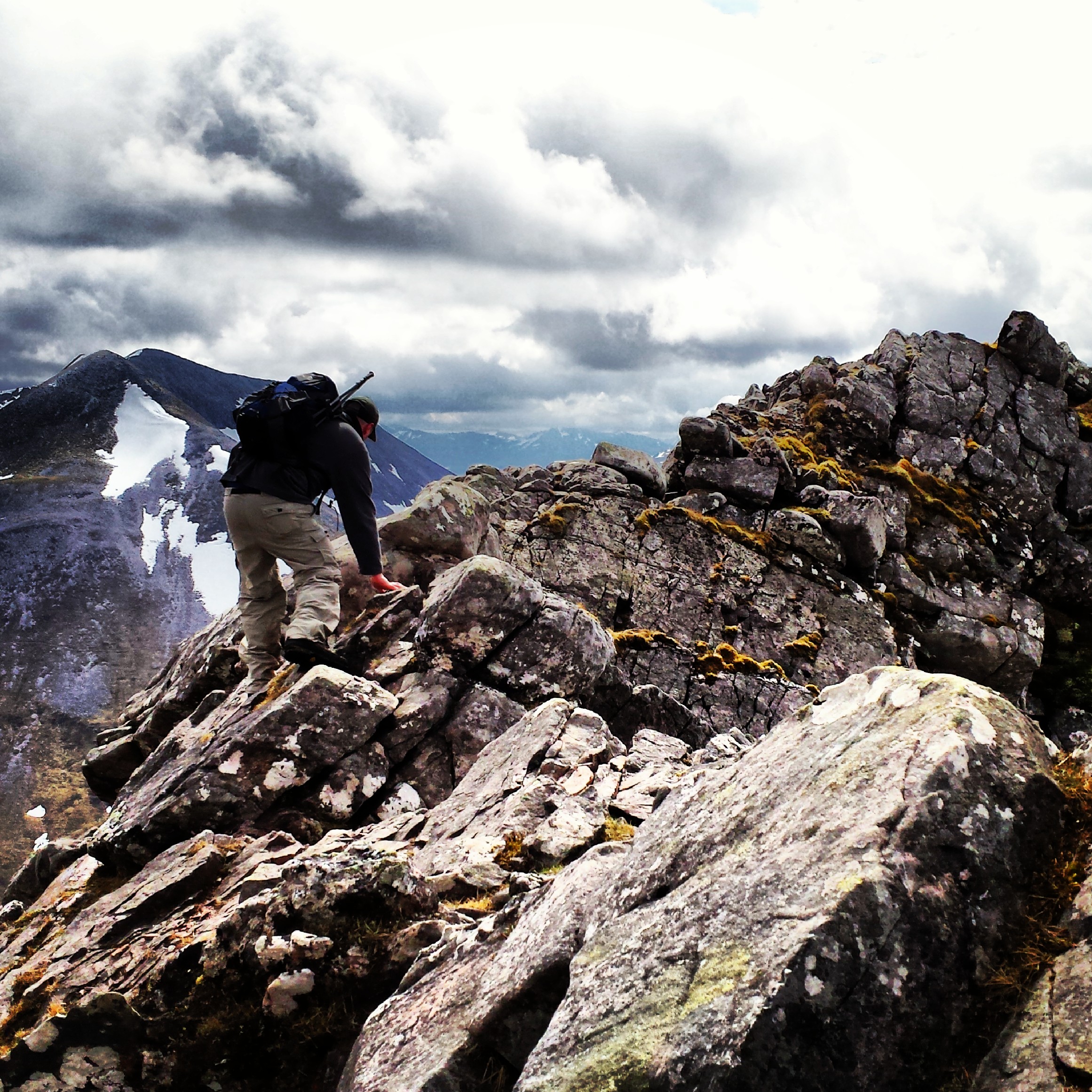
Descending towards to bealach between the three Munros. Glas Bheinn Mhor in front.
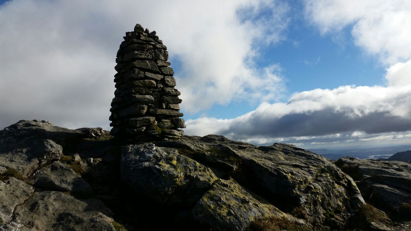
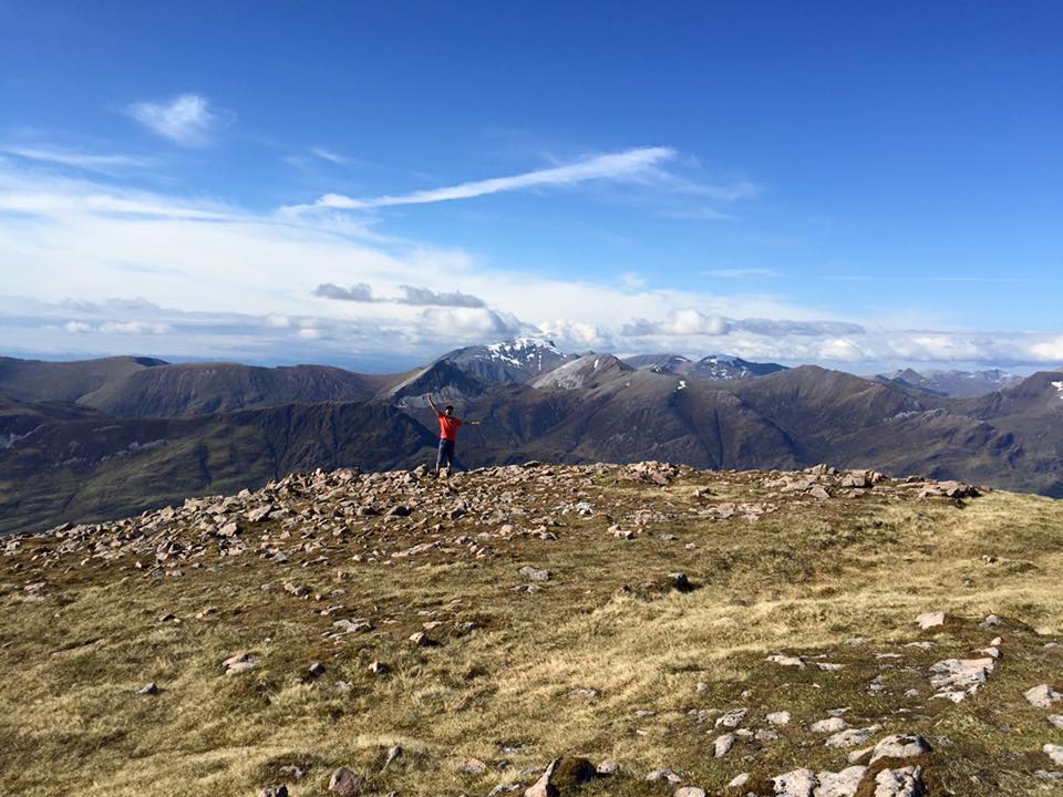
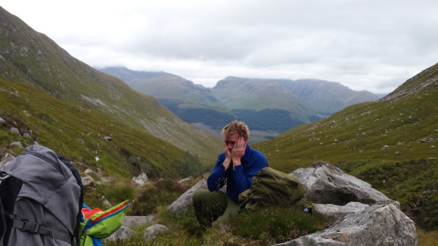
By the time we had reached the start of the ascent to Beinn nan Aighenan we had already agreed that the plan to climb five munros was scuppered. We decided that doing three was enough for today since it looked like the mist hanging over Glen Etive didn’t feel like moving. We had dumped our packs at the bealach before we started climbing to the summit. The full way up, the cloud got thicker and thicker and our views got poorer and poorer. When we reached the summit cairn, we literally trudged up to it, got a photo and turned and left. Absolutely pish. Don’t think I’ve ever done that before. I’ve seen other people do it, even in glorious weather: storm up to a summit cairn like one of these power walkers – doing their best to walk as fast they can without actually running. They end up looking like maniacs running for the toilet clenching their arse together incase the unspeakable happens. Then they tap their walking pole off the top of the cairn and bolt away again. Weird.
As we descended the exact same way we walked up, talk of leaving Glas Bheinn Mhor for another day crept into conversation. What was the point in carrying a full pack up a third mountain for us to do the same as we had just done: get a pointless photo in crappy weather and then leave? I can’t even remember who brought it up, but the rest of the group wholeheartedly agreed in a nano second. We also agreed that camping in the glen would be pretty rubbish as well. Not so much for me in my tent, but for Jim and Rory in their bivvy bags. But we were definitely not going home early, nae way. So the welcome suggestion of spending the night in a bothy just up the road was accepted. We got back down to where we had left our packs, and ate our lunch. The epic trip of getting ourselves around The Ben Starav 5 hadn’t happened. We all felt pretty miserable about it, but it was a group decision and we were bailing out for fair enough reasons.
Says it all…
Sitting munching my sandwich, I still felt pretty gutted and my mood never really lifted as we walked back down into the glen. But getting to eat my breakfast as I experienced my first mist inversion, and then spending the night in a great wee bothy without a doubt made the trip worthwhile. Swings and roundabouts, eh?
As I mentioned earlier on. Every trip… every single trip, gifts me with something. One thing that I can talk about time and time again, long after I’m off the hill. And this trip was certainly no different.